Centenary Trail Canberra Guide: 145km Bike Loop Through Nature, History & Suburbia
Words by Annie Arnott | Photos by Nick Waygood
Circumnavigating Australia’s biggest country town on the Centenary Trail
Key Details
- Trail Name: Centenary Trail (aka “Centenno”)
- Location: Canberra, ACT, Australia
- Length: 145km loop
- Trail Type: Multi-use trail for walking and cycling
- Sections: 7 sections averaging 20km each
- Terrain: Mix of fire trail, singletrack, and urban bike paths
- Highlights: Red Rocks Gorge, Mount Ainslie, Mulligans Flat, Black Mountain, Stromlo Forest Park
- Best For: Gravel bikers, MTB riders, XC riders, bikepackers, and families
- Skill Level: Beginner to intermediate depending on section
- Access Points: Multiple entry points around Canberra suburbs
- Navigation Tools: Trailforks, in-situ signage (limited Google Maps visibility)
- Unique Feature: Only capital city in the world that can be fully circumnavigated by bike
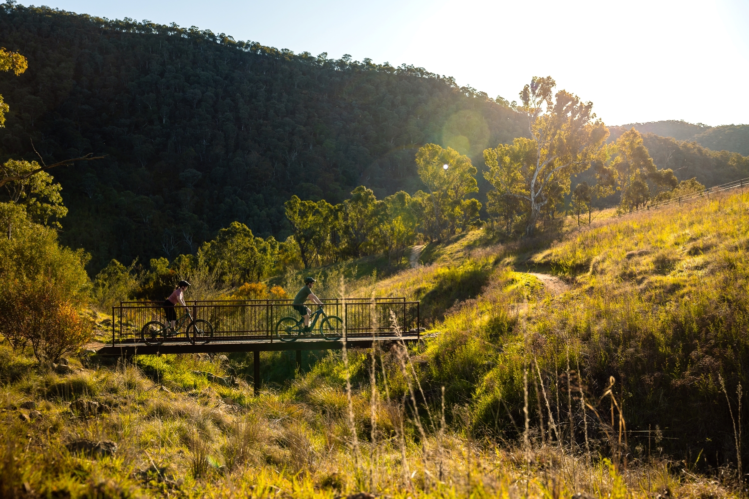
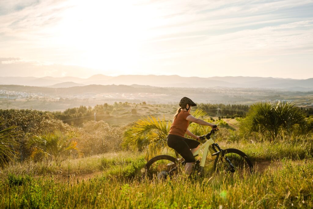
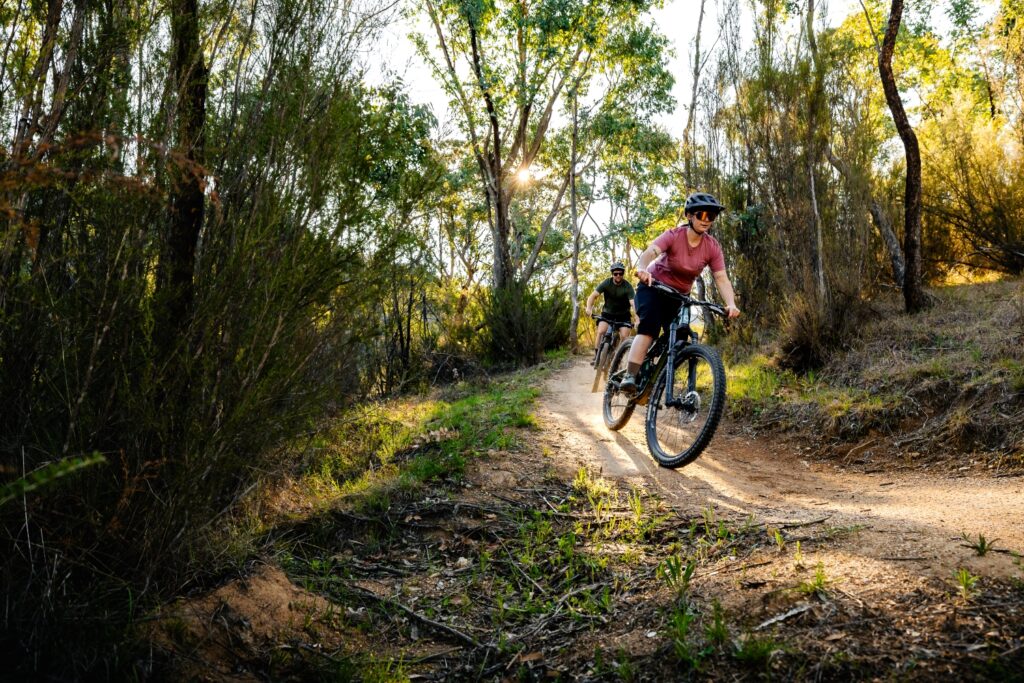
How many cities in the world can you circumnavigate? I don’t know of any other than our very own Canberra, circumnavigable by the Centenary Trail. Commissioned by the Australian Capital Territory government to celebrate the centenary of the capital back in 2013, the ‘Centenno’ was designed for both walkers and cyclists and meandering around the bush capital for 145 kilometres, with stunning vantage points to view the city and its surrounds and take in natural, Indigenous and recent history.
About the Centenary Trail
The trail is broken down into seven sections and each section is about 20km. Trail users can tackle the Centenno one section at a time but for dedicated cyclists, the entire trail is definitely doable in a single day with the right attitude. Given Canberra’s melding of bushland and suburbia, there are cafes, shops and licensed establishments along the way for replenishment to keep the wheels spinning.
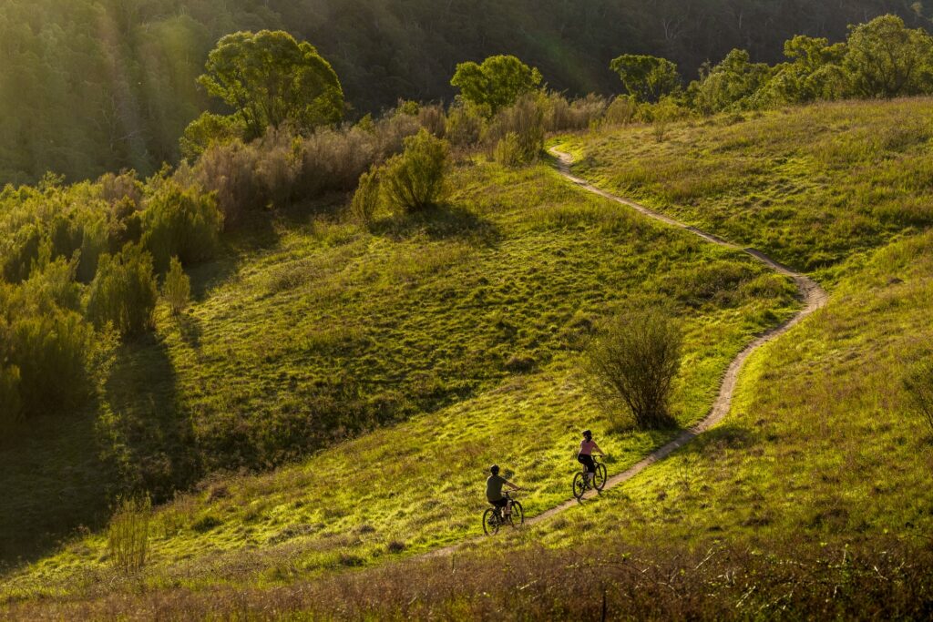
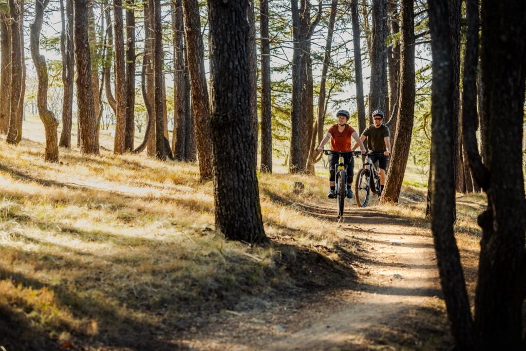
The trail varies from fire trail and single track to asphalt bike path. Some parts are decidedly more urban than others, thanks to the bike path that winds through centres like Tuggeranong and Belconnen. Other parts feel spectacularly far from civilisation. Nearly 10km of the Stromlo Forest Park to Tuggeranong Town Centre section is nestled along the Murrumbidgee River with the Bullen Range on the other side and no city or suburban vistas to suggest you’re in the nation’s capital.
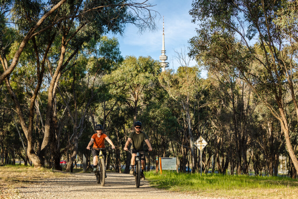
The compact nature of Canberra means the trail is accessible from almost anywhere in the city within 10 or 15 minutes. Staying in Civic? Head to the War Memorial and jump on the track there to get up to Mount Ainslie and Mount Majura. In Forrest or Barton? Red Hill Nature Reserve is right there. Live north side? Get thee to One Tree Hill or Black Mountain for your nature fix. A southsider? Any number of access points will get you to Kambah Pool, Pine Island or Isaacs Ridge Nature Reserve.
History buffs are well-catered for, with pre-capital surveyor’s marks, an old stone fence, Indigenous history and the various historic sites in the Parliament House area. Nature nerds can go ga-ga at flora and fauna, from epic old trees to Peregrine falcon nesting areas, Red Rock Gorge, gang-gang cockatoos and echidna love trains.
Nature nerds can go gaga at the range of flora and fauna, from epic old trees to Peregrine falcon nesting areas, Red Rock Gorge, gang-gang cockatoos and echidna love trains.
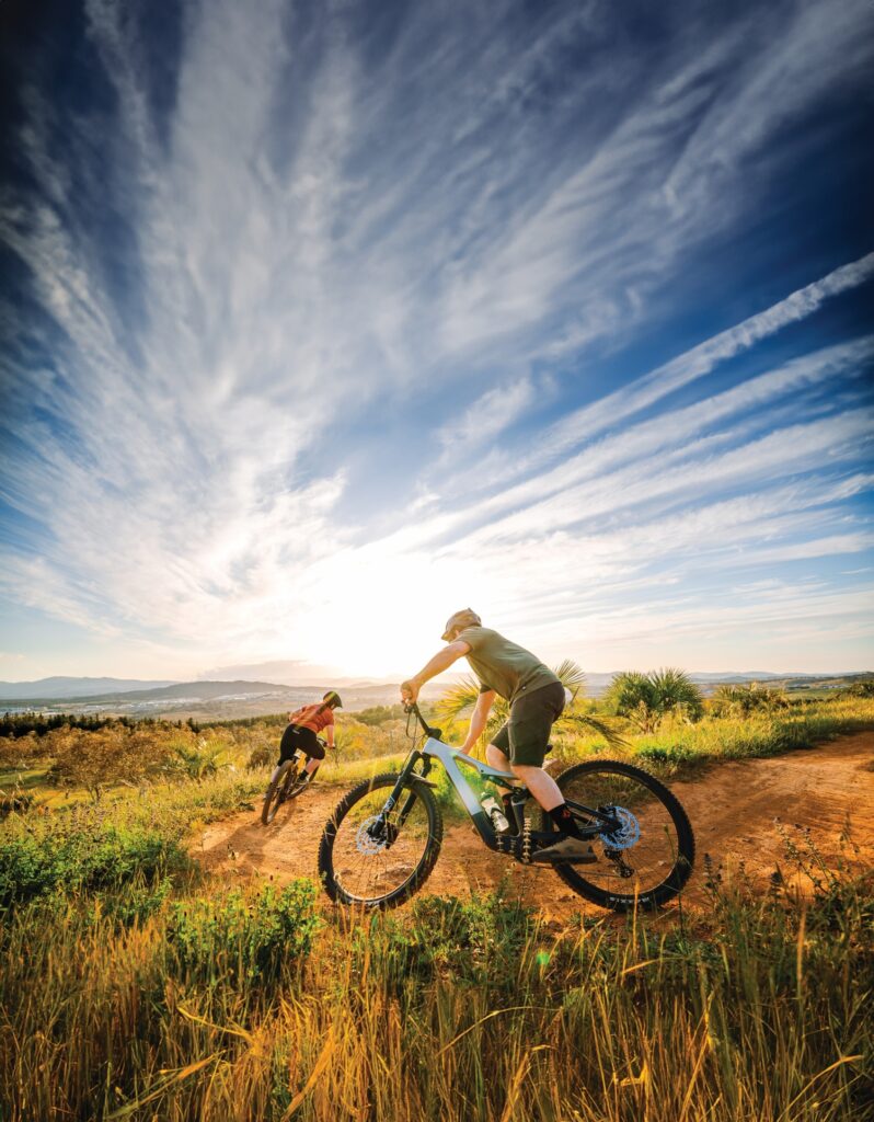
Alternatively, you can just huff and puff your way up and back or around whichever section of trail you choose. I’ve ridden it on an enduro bike (Hall to Forde and part of the Black Mountain to Stromlo section at the Arboretum, which I would have liked to have ridden on my gravel bike) and on a gravel bike (Kambah Pool to Tuggeranong Centre, when I wished I was on my enduro bike). That said, the bike you have is the best bike to ride!
Given the length of the trail, of course, there will be parts that highlight the shortcomings of whatever steed you’re on. Depending on the section, your peccadilloes and your bike of choice, one direction might be more enjoyable than the other. My humble opinion is a short to mid-travel bike, with remote lockout, would be the best to tackle any part of the trail – or indeed the whole thing.
How to find the Centenary Trail
Given the trail goes all around the city, there’s no set start point. If you see the Centenary Trail sign, you’re on it. There’s also no set direction, so you can jump on and head whichever way the wind takes you. The trail is two-way and is open to walkers and cyclists alike, so as always, a bit of trail etiquette is important.
While Google Maps and the Centenary Trail website aren’t much help, some of the reserves the Trail goes through have maps in situ and online that show the ‘Centenno’ and other trails within it. Trailforks is always there to fill any void in navigation.
Where the trail becomes more suburban, it can feel a bit as though you’ve lost the trail. But all roads lead back to the Centenno (assuming you continue heading in the direction of the trail), and, in my experience, a sign eventually appears, so keep your eyes peeled for those.
Before you set out, be aware that while the trail weaves in and out of the suburbs, access to water and other amenities can be minimal at times. Some sections of the trail are exposed and remote, with no vehicle access. Expect to encounter wildlife from kangaroos to snakes, and be prepared for all bike- and weather-related eventualities. Read on for some popular sections or routes within those sections.
Parliament House to Watson ~17km
This section goes from Parliament House to the War Memorial and through the Mt Ainslie and Mt Majura nature reserves. Mt Majura gets a mention here – it is home to some of the nastiest climbing and loamiest descents in Canberra. Maintained by the volunteer-run Majura Pines Trail Alliance, these are some of Canberra’s oldest mountain bike trails, and whether you love to grind to the top or prefer to get down, if you’re riding that section of the Centenno, you must take a detour to sample Mt Majura mountain bike trails.
Watson to Northern Border Campsite ~18km
This full section of trail, as intended by the trail’s designers, goes past the Hughie Edwards VC rest area before getting into nature reserves Goorooyaroo and Mulligans Flat, then out to the Northern Border Campsite.
Mulligans Flat Wildlife Sanctuary is home to endangered wildlife, including two different types of quoll as well as echidnas, shingleback lizards and other small precious marsupials. Open to the public but protected by gates and large fences, the sanctuary contains walking, running and cycling trails, which offer the opportunity to see some special critters. If visiting in late winter/early spring, keep your eyes peeled for echidna love trains! And if making the trail at twilight or later, keep watch for nocturnal quolls and bettongs. Mulligans Flat has maps and is well signposted throughout and is well worth checking out as an additional nature-fix or family-friendly detour from the Centenno.
The Northern Border Campsite is available for bookings with a permit required for commercial groups, trail users can use this basic campsite for a well-earned night’s rest on their way around the trail or stop in for a rest and snack at the sheltered picnic tables and to use the (basic) amenities before continuing along the trail.
Hall to Forde (or Forde to Hall) via One Tree Hill. ~20km
This route takes in parts of the Watson to Northern Border Campsite and Northern Border Campsite to Hall sections. Hall is a small town to the northwest of Canberra with a rather rural farming feel and plenty of cafes, bars and eateries to start or finish your ride. At the other end, Forde is a new-ish suburb with small local eateries and one of the entry points into Mulligans Flat.
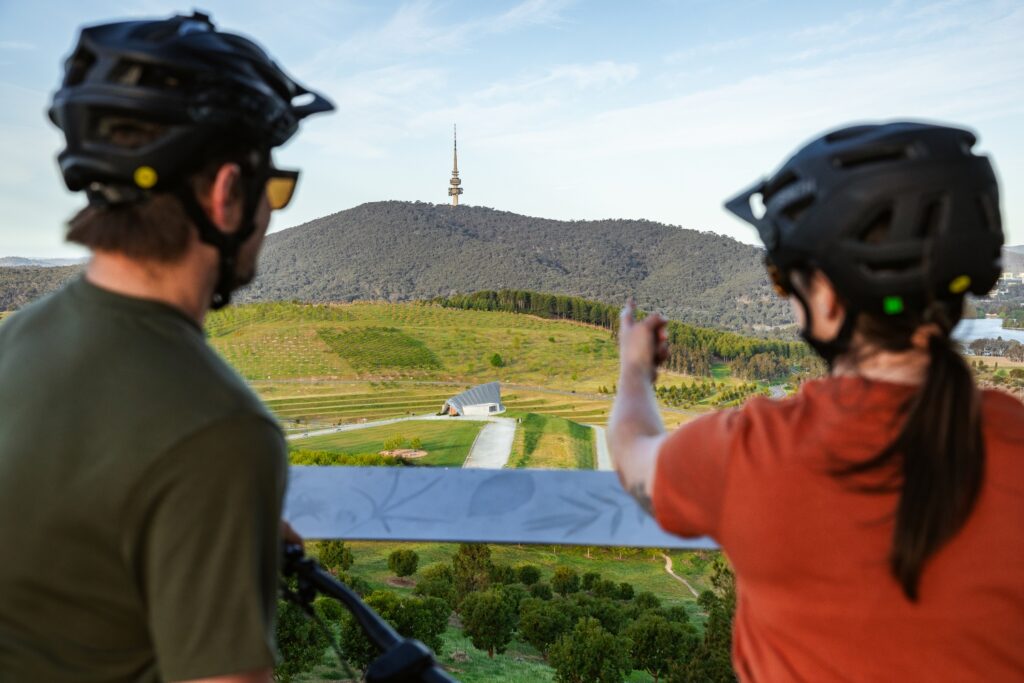
This route is popular with trail runners and hikers – when I rode it on a blustery August Saturday, there were trail runners, XC whippets and e-bike riders whizzing along the trail, but it also lends itself to a leisurely pace. The trail meanders past farmland and through delightful stands of native trees. In one spot, there is a tree that grows from both sides of the track, which is pretty special (and a great spot for a photo and a snack). One Tree Hill offers spectacular views to the south over Canberra, with Black Mountain Tower and other landmarks popping up out of the bush.
The trail is mostly mellow with some mild gradients. There are a few spots with fun corners that are over too soon, and just after the Northern Border Campsite, the trail climbs up to One Tree Hill with steep, tight hairpin switchbacks into something of an upward grind – unless you’re travelling the other way, in which case it’s a gentle descent into some fast corners to the campsite.
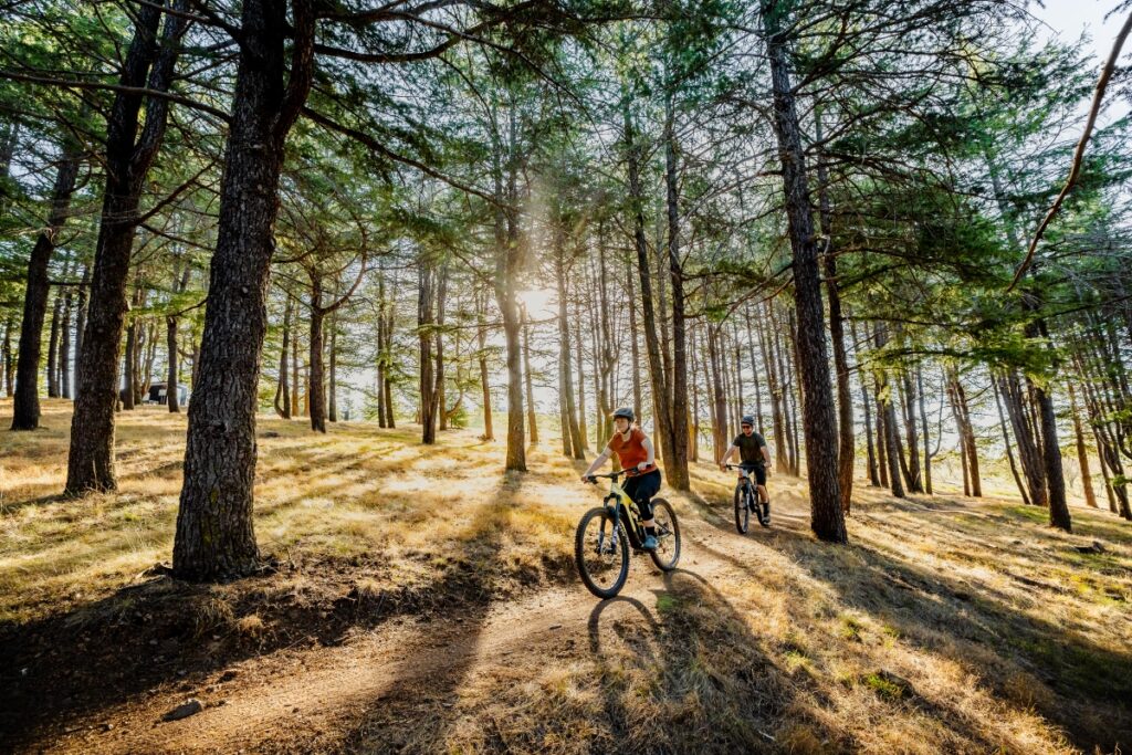
Black Mountain to Stromlo Forest Park- ~20km
Between Black Mountain and Stromlo Forest Park is the Arboretum, made up of ‘living collections’ of trees. From the north, the Centenno joins the Arboretum at the Cork Forest. To the south, it joins onto Fire Road after meandering through young gums. The trail goes through a stand of 100-year-old Himalayan Cedars, which are very cool (even if you’re not a card-carrying member of the I Love Trees club).
There are trails running all through the Arboretum, so you can choose your own adventure, and if you need replenishment, want to see kite-flying or the bonsai display, detour over to the main pavilion.
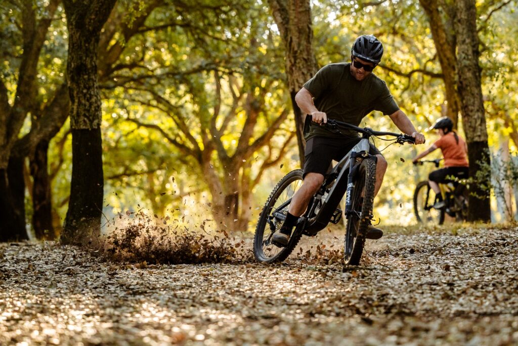
I personally recommend riding the western side of the Arboretum in the late afternoon as it makes for epic golden hour light in the trees, ranging from Christmas tree-esque pines to eerie snow gums and a cool stand of older pines. It also has some fun single-track turns to roost (or sensibly pedal through). The eastern side during autumn is also special thanks to the deciduous trees there, and if riding this side on an early morning during the colder months, expect to see hot air balloons over the lake. Iconic.
To the south, the Centenno goes through Molonglo Pines on Fire Road, then onto a bike path past the newish suburb of Coombs into Stromlo Forest Park. A detour via single track, fire trail or shuttle to the top for some tech or flow would round out your cycling adventure. At the base of Mt Stromlo is the licensed Handlebar which offers local tipples on tap as well as freshly made burgers, toasties and the best chippies in the city. Check their Instagram for current opening hours.
Kambah Pool to Pine Island. ~9.5km
This is part of the Stromlo Forest Park to Tuggeranong Town Centre section and I think this is one of the most iconic parts of the Centenno.
There is neither a pool nor an island in either location. Both are popular spots along the Murrumbidgee River for swimming and picnicking, with parking, public amenities and barbecues. The Centenary Trail joins them with just shy of 10km of mostly single track, which has some fun, flowy corners (south to north) and some spots where riders can really grind their way up the trail (north to south).
The Red Rocks Gorge lookout offers a spectacular spot for a break with views of the Red Rocks and Murrumbidgee River. Red Rocks Gorge is one of only seven breeding locations for Peregrine falcons within the ACT, so keep your eyes peeled for some big birds!
Further south, closer to Pine Island, there is a remnant of an old stone fence from pre-capital pastoral days. Not quite Hadrian’s wall, it is one of the historic gems along the trail.
The trail gets a bit sandy towards Pine Island, but some fun corners are waiting for users to climb up out of the river flat and into the reserve at Pine Island.
A word of warning: there is a designated clothes-optional swimming spot north of Kambah Pool. The trail doesn’t go past there, but just in case you want to explore that bend of the Murrumbidgee, you might find stripping out of sweaty cycling gear is a much more … chill proposition there.
Tuggeranong Town Centre to Parliament House ~26km
This section starts in the Town Centre on cycle paths before hitting the fire trail through Wanniassa Hills to Mt Mugga through Isaacs Ridge Reserve. Isaacs Ridge Reserve is an area of pine forest backing onto the somewhat ritzy suburbs of Isaacs and Farrer. Within the reserve is the Spur, a green-rated two-way single track, and some old-school downhill trails (North downhill and South downhill corridors). Keep your eyes and ears open for riders coming down the hill toward the Centenary Trail! Dog walkers, trail runners and horse riders frequent this reserve.
From Isaacs Ridge, the trail goes past O’Malley (a suburb home of huge diplomatic residences and huge architectural homes) via Mt Mugga, then into Griffith via the Red Hill reserve. Within the Red Hill reserve, cycling is only permitted on the Centenary Trail, but the top of Red Hill offers stunning views back to the south over the Bullen Range and to the north over the inner south to Mt Majura. The reserve is a breeding habitat for the Gang-gang cockatoo and other vulnerable species of flora and fauna, so it is well worth another visit in sneakers. From Red Hill, the trail gets more urban and offers the opportunity to stop in at one of the many eateries and watering holes in Manuka before getting to the Parliament House precinct.
Final word on the Centenary Trail
Your humble correspondent is not a seasoned Centenno rider, so this round-up is by no means exhaustive. Hopefully, no matter what flavour of bike you prefer, you are inspired to get out there and explore it for yourself! Keep an eye out for Centenno signs, be a good human on the trail, be prepared and have fun.